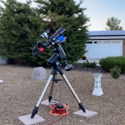


The keogram is created by taking a single vertical row of pixels from the center of the individual frames that are used to create your timelapse videos. In my case, it is taking a single row of pixels every minute and stacking them into an image with a timeline running along the bottom.
Here's an image taken at 10:58pm local time last night.

Now take a sliver of the pixels from this image and stack it along the timeline at 10:58. The red vertical line actually covers 4 pixels in this sample because a single row of pixels is very narrow and it would be difficult to see the red line if it were that small.

Later in the morning around 2:26am local time you can see the moon has moved a considerable distance and that strip in the center is covering nothing but clear, dark sky.


If you look back at the full keogram you can see at around 2:26am the sky was clear and dark.
The purpose of the keogram is to give you a 24hour snapshot of your weather in a single image. The time span of this particular keogram is from 9:30am to 9:30am and looking at my image you can see the sky was cloudy from around 9:30am yesterday until around 8pm (20:00) when it cleared up. Then, around 5am this morning it started to get cloudy once again.
It's a great tool to use if you are imaging all night unattended. When you finish your observing run you can look at the keogram for the night and see if any time period was obstructed by clouds. Even faint, thin clouds that might not stop an imaging session can be detected so you know to be leery of the data collected during that time period.
As a bonus, since my camera is oriented so that north is at the top, south at the bottom, the keogram takes that sliver of data roughly down the
Here's a Wiki for Keograms that might explain it better than I did. https://en.wikipedia.org/wiki/Keogram
My timelapse videos only cover sunset to sunrise and here is the video that covers a portion of that 24hr keogram.
You can pause the video at any point in time and compare it to that sliver of time in the keogram!